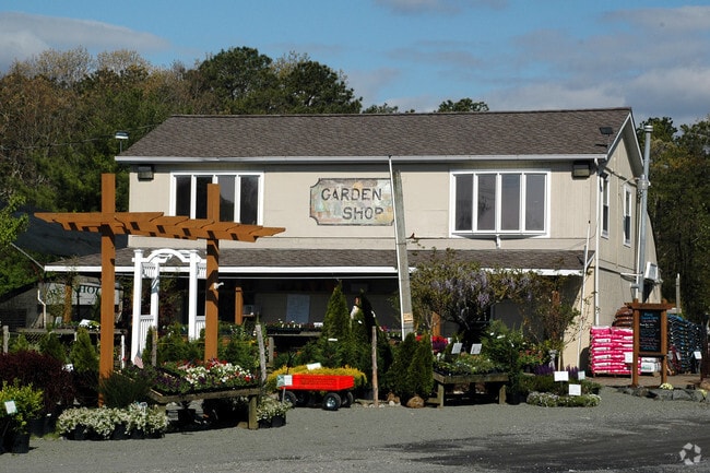
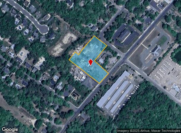
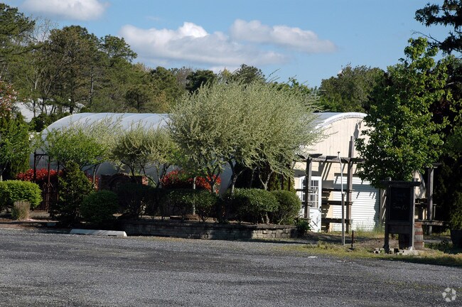
Property Record
229 S Main St, Barnegat, NJ 08005
NEARBY LISTINGS FOR SALE OR LEASE
Property Detail
229 S Main St
New York-Jersey City-White Plains, NY-NJ
Minor Sub
01-00174-03-00038-01
2.20 AC 38.04 HOCHS LANDSCAPIN
Commercialnec
Ocean
X
New Jersey
34029C0501G
38.1
2024
2.20 AC
2025
Ocean County
734003
Northern New Jersey
2,880 SF
DEMOGRAPHICS near 229 S Main St
1 Mile
3 Mile
5 Mile
2024 Total Population
5,917
34,850
60,656
2029 Population
6,228
37,210
65,111
Pop Growth 2024-2029
+ 5.26%
+ 6.77%
+ 7.34%
Average Age
36
43
43
2024 Total Households
1,910
13,092
23,505
HH Growth 2024-2029
+ 4.82%
+ 6.38%
+ 6.96%
Median Household Inc
$69,835
$89,162
$87,012
Avg Household Size
3.00
2.60
2.50
2024 Avg HH Vehicles
2.00
2.00
2.00
Median Home Value
$253,700
$315,904
$315,295
Median Year Built
1978
1992
1993
Nearby Places
Map Layers
Map Styles
 Street
 Aerial
- Restaurants
- Banks
- Shops
- Fitness
- Groceries
PUBLIC TRANSPORTATION
AIRPORT
Atlantic City International
DRIVE
WALK
Distance
Atlantic City International
65 min
35.3 mi
Freight Ports
South Jersey Port
DRIVE
WALK
Distance
South Jersey Port
71 min
53.0 mi
Nearby Properties
Address
Land Use
TOTAL SIZE
Lot Size
Zoning
Address
Land Use
TOTAL SIZE
Lot Size
Zoning
85.65 AC
R40
Address
Land Use
TOTAL SIZE
Lot Size
Zoning
46.40 AC
ML-4
Address
Land Use
TOTAL SIZE
Lot Size
Zoning
13.83 AC
CN
Address
Land Use
TOTAL SIZE
Lot Size
Zoning
85.65 AC
R40
Address
Land Use
TOTAL SIZE
Lot Size
Zoning
13.99 AC
MLSC
Address
Land Use
TOTAL SIZE
Lot Size
Zoning
91.97 AC
RGL/
Address
Land Use
TOTAL SIZE
Lot Size
Zoning
7.49 AC
R20
Address
Land Use
TOTAL SIZE
Lot Size
Zoning
6,600 SF
10.67 AC
PRD
Address
Land Use
TOTAL SIZE
Lot Size
Zoning
67,548 SF
10.98 AC
CN
Address
Land Use
TOTAL SIZE
Lot Size
Zoning
86,000 SF
2.87 AC
R20
Address
Land Use
TOTAL SIZE
Lot Size
Zoning
37.27 AC
RGL/
Address
Land Use
TOTAL SIZE
Lot Size
Zoning
6.36 AC
RGL/
Address
Land Use
TOTAL SIZE
Lot Size
Zoning
23.70 AC
BCWD
Address
Land Use
TOTAL SIZE
Lot Size
Zoning
89.90 AC
R-2
Address
Land Use
TOTAL SIZE
Lot Size
Zoning
56.23 AC
BC
Address
Land Use
TOTAL SIZE
Lot Size
Zoning
11,695 SF
9.31 AC
R20
Address
Land Use
TOTAL SIZE
Lot Size
Zoning
4,230 SF
10.65 AC
CPHD
Address
Land Use
TOTAL SIZE
Lot Size
Zoning
4.85 AC
CPHD
Address
Land Use
TOTAL SIZE
Lot Size
Zoning
398 AC
PW
Address
Land Use
TOTAL SIZE
Lot Size
Zoning
3.34 AC
C-1
Address
Land Use
TOTAL SIZE
Lot Size
Zoning
5.14 AC
CPHD
Address
Land Use
TOTAL SIZE
Lot Size
Zoning
58,375 SF
5.46 AC
CPHD
Address
Land Use
TOTAL SIZE
Lot Size
Zoning
37,476 SF
14.66 AC
R6
Address
Land Use
TOTAL SIZE
Lot Size
Zoning
11.91 AC
RA
Address
Land Use
TOTAL SIZE
Lot Size
Zoning
30.95 AC
ML-P
Address
Land Use
TOTAL SIZE
Lot Size
Zoning
52,212 SF
4.41 AC
TCCN
Address
Land Use
TOTAL SIZE
Lot Size
Zoning
32,964 SF
4.01 AC
RB
Address
Land Use
TOTAL SIZE
Lot Size
Zoning
6.84 AC
MLP
Address
Land Use
TOTAL SIZE
Lot Size
Zoning
31,658 SF
5.88 AC
TCCN
Address
Land Use
TOTAL SIZE
Lot Size
Zoning
140.88 AC
RLAC
The World's #1 Commercial Real Estate Marketplace
Connect with us
© 2025 CoStar Group
The information above has been obtained from sources believed reliable. While we do not doubt its accuracy we have not verified it and make no guarantee, warranty or representation about it. It is your responsibility to independently confirm its accuracy and completeness. Any projections, opinions, assumptions, or estimates used are for example only and do not represent the current or future performance of the property. The value of this transaction to you depends on tax and other factors which should be evaluated by your tax, financial, and legal advisors. You and your advisors should conduct a careful, independent investigation of the property to determine to your satisfaction the suitability of the property for your needs.